INTERVALS
2013w/ Jason Butz
Project location: Nashville, TN
A new active neighborhood on the Cumberland river.
Brief:
Nashville is no stranger to performance. Through its pervasive music industry and culture, it brings communities together. Intervals expands on the city’s commitment to integration, and provides a field of action as a communal neighborhood that promotes vitality. Already a regional center for many industries, Nashville now has the opportunity to be the capital of active and healthy living in the region.
Intervals is a landscape urbanism proposal that is simultaneously interested in the equilibrium and disequilibrium of the relationship between water, land, and the built-environment in floodplains. It challenges the common perception that land is a victim of water in the case of floods, and its accompanying rigid flood-wall boundaries, to propose a negotiated interface where the river, the land, and the built environment can co-exist actively.
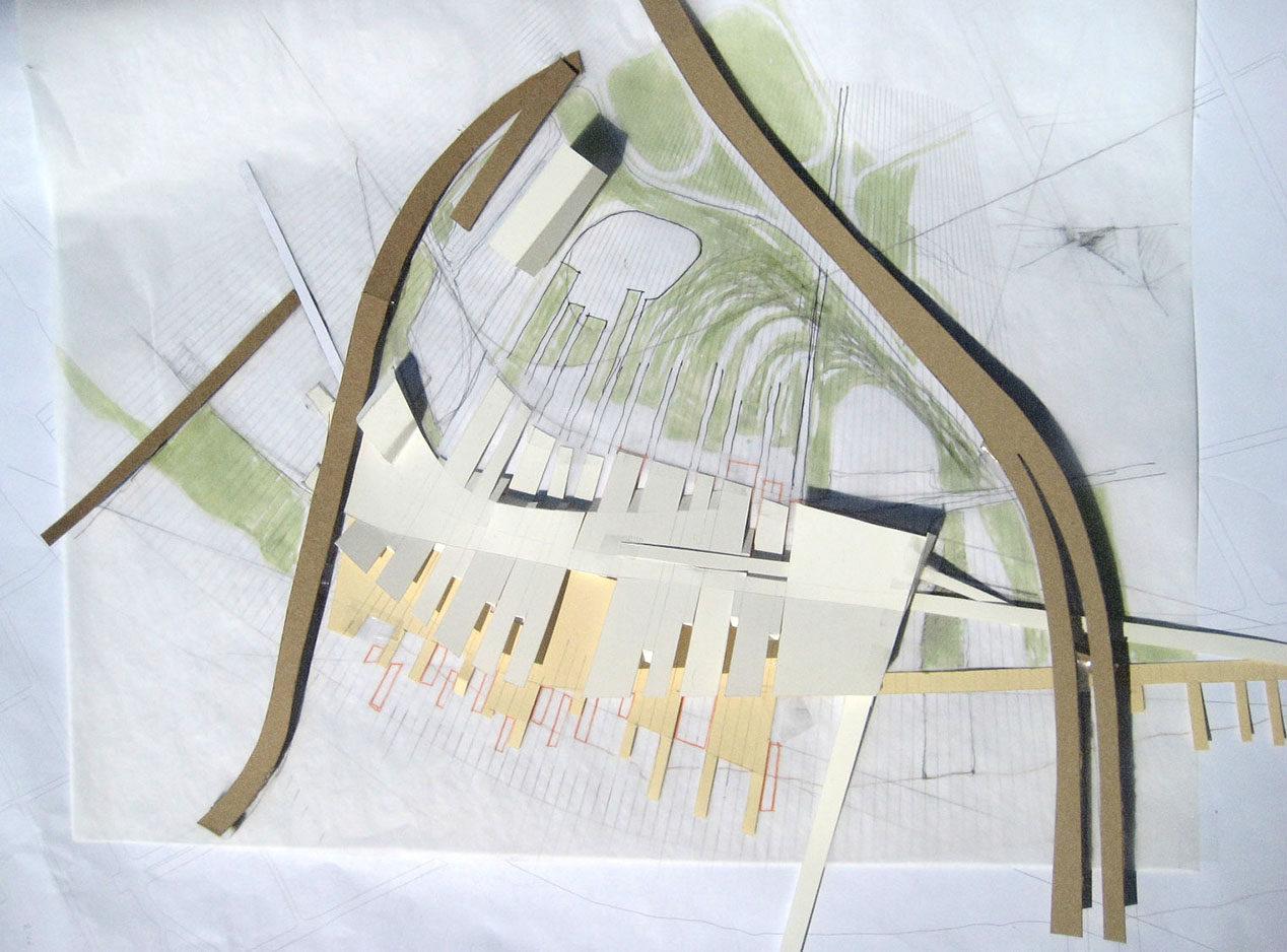
Working model

Site Plan
NATURAL SYSTEM PRECEDENT: The proposal looks to sedimentary structures and fluvial geomorphology in the form of Avulsion as a natural precedent. Both reveal various organizations and behaviors that are critical systemic and formal precedents; particularly in regions that are prone to flooding. Just as Avulsion occurs when a river abandons a river channel and forms a more favorable one, so does the proposal provide options for new courses of the river, in case it were to flood. It avoids damage to the built-up landscape, and allows for continued usage while flooded. This way, the proposal diffuses the precedence that land takes over water in cases of floods.
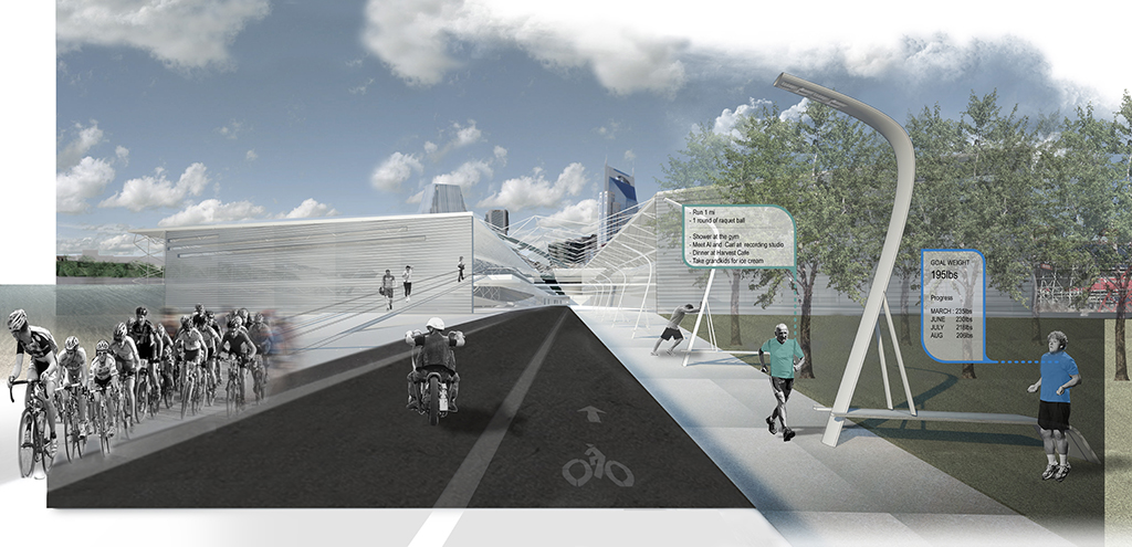
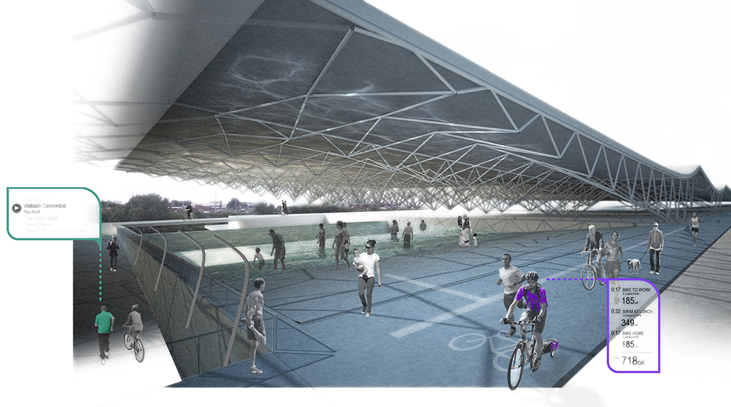
PROGRAM: The proposal is for a recreational and health facility on a brownfield site within the floodplain of the Cumberland river in Nashville. Here, people can engage in a range of activities of varying intensities. In case of flooding, the built landscape continues to provide an armature that supports the storage and distribution of emergency supplies and services.
EXPRESSION: The project expresses itself in the form of swash lines in the ground. Over this, the building rises up in a porous manner, layered over 5 datums. As the river floods, various datums are progressively diffused to allow for a momentary exchange of water and land -- just like in the tidal dynamics of bedforms on river banks and active beaches.
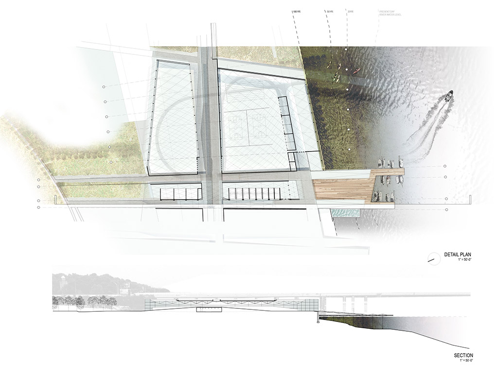
Detail plan and section

Character profiles and Flood Plain Projection


Detail Sections

